

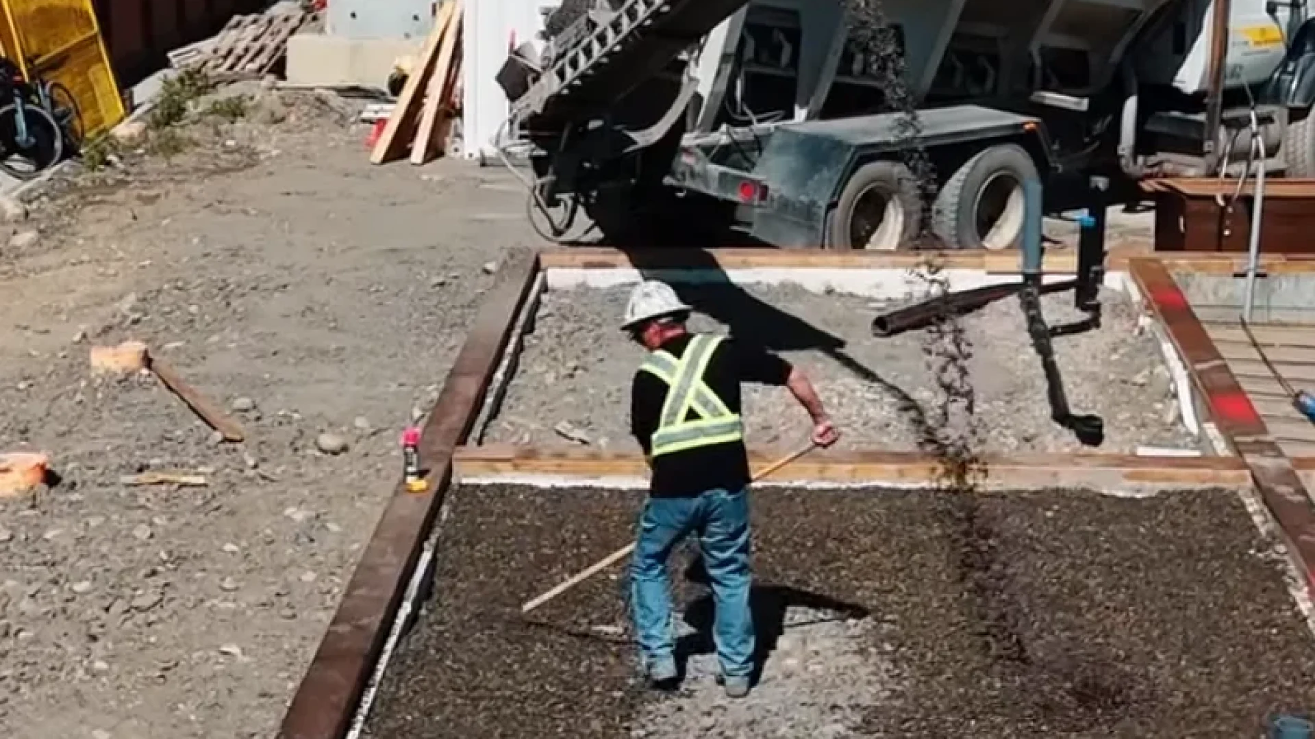
The soil report your realtor calls ‘standard’ lists six things that matter. Bearpaw smectite clay 10%+ swells when wet. Paskapoo bedrock at 4.2 m is the bearing layer. The 38 years our crews have spent cribbing across these six Calgary soils means we can name the failure mode each one delivers — usually in year 3 to 7.
A Cranston homeowner sent us a pre-purchase soil report in May 2026 on a 2018 build she was about to close on. The report named “Bearpaw smectite,” “lacustrine silty clay,” and “weathered Paskapoo bedrock at 4.2 m.” Her realtor told her “all soil reports look like that.” That advice cost a different buyer $42,000 three years earlier on a near-identical lot.
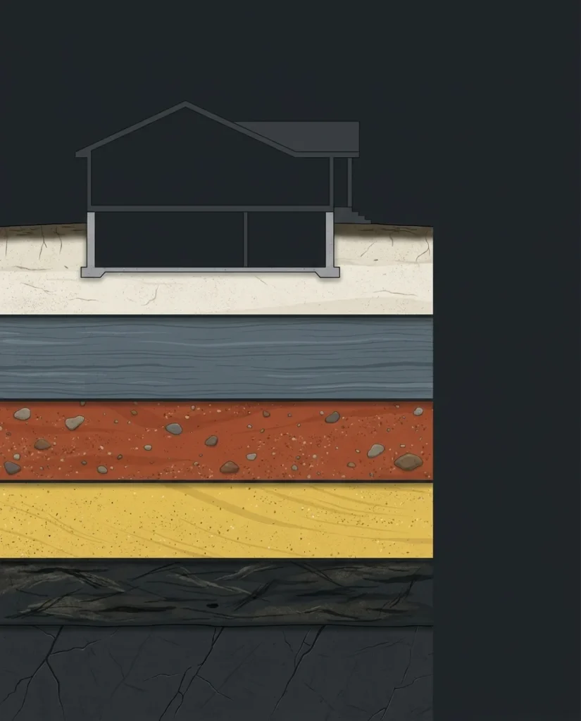
Calgary’s geology stacks at least six distinct soil profiles under the city and the surrounding acreage belt, and each one delivers a different failure mode when ignored. The Alberta Geological Survey Bulletin 053 maps these soils in detail. This article walks through all six — what they are, what to look for in your geotech report, and what the failure looks like in year 3 to 7 if the foundation system doesn’t match the soil.
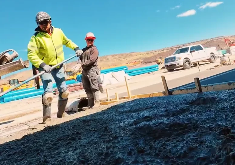
1. Bearpaw Formation smectite clay (Calgary east + southeast belt)
The Cranston soil report we mentioned listed “Bearpaw Formation, smectite-rich, plasticity index 35–55, swell potential HIGH” at 1.8 to 4.2 m depth. That single phrase carries more cost implications than every other line in the report combined.
The Bearpaw Formation is a Late Cretaceous marine shale and clay sequence that underlies much of east and southeast Calgary — Lake Bonavista, Auburn Bay, Mahogany, McKenzie Towne, Cranston, Seton, and the McKenzie Lake belt. It was deposited at the bottom of the Western Interior Seaway roughly 75 million years ago. What makes it dangerous to a basement wall is its smectite content. Smectite is the swelling-clay mineral family that includes montmorillonite, and it can absorb water molecules into its crystal lattice.
The Bearpaw’s smectite content drives a 10 to 15 percent volumetric swell from dry to saturated conditions, and lateral pressures on a saturated 8-foot basement wall can reach 50 to 90 kPa per Alberta Geological Survey Bulletin 053 and published geotechnical literature on Bearpaw behaviour.
The geotech markers to look for in your soil report are specific: plasticity index above 25, liquid limit above 50, a swell potential classification of “moderate to high,” and on more detailed reports, smectite identification confirmed by XRD analysis. Most southeast Calgary residential geotechs flag Bearpaw within the top 5 m of borehole depth. If you see the word “Bearpaw” or “marine shale” or “high plasticity clay” with PI greater than 25, that’s the soil.
Bearpaw is the single most common cause of horizontal mid-wall cracking we see in southeast Calgary basements between year 3 and year 7. The clay re-wets each spring, swells against the wall, and a crack opens in a horizontal band — typically 4 to 6 feet up from the footing where bending moment peaks.
The engineering response is straightforward but non-negotiable: clean granular backfill (never native clay returned to the trench), continuous dimple-board drainage against the wall, weeping tile to a positive outlet, and a conservative wall design that often calls for 8 to 10 m³ of rebar density on a typical basement footprint. See 6 Calgary Foundation Mistakes That Cost $50K by Year 10 for the cost arithmetic on each of these.
That’s one of the two Cretaceous bedrock formations under Calgary. The other one — Paskapoo — sits beneath much of central and west Calgary and behaves very differently.
Understanding the soil is only the first step. Once excavation begins, coordination between the geotechnical engineer, foundation contractor, concrete supplier, and inspection team becomes just as important. Learn the 8 costly concrete coordination failures that delay Calgary multi-family projects by weeks to see why scheduling mistakes often become more expensive than the soil itself.
2. Paskapoo Formation bedrock + weathered fines (central + NW Calgary + foothills)
A Bragg Creek custom-build soil report we reviewed in March 2026 listed “weathered Paskapoo Formation at 3.8 m, intact bedrock at 6.1 m, allowable bearing capacity 600 kPa” — confirming the foundation could bear on weathered bedrock at typical footing depth. That report told a very different story than the Cranston one.
The Paskapoo Formation is a Paleocene sandstone, siltstone, and claystone sequence approximately 600 m thick, forming the bedrock under most of west and northwest Calgary and the foothills — Killarney, Hillhurst, Bowness, Springbank, parts of Cochrane, and the Bragg Creek acreage belt per Alberta Geological Survey Bulletin 053.
It was deposited in fluvial and lacustrine environments roughly 60 million years ago, after the Western Interior Seaway had withdrawn. Bearing capacity on intact Paskapoo is high — 600 to 1,500 kPa is typical — and weathered Paskapoo fines have moderate plasticity and lower but still useful bearing.
The geotech markers for Paskapoo are different from Bearpaw in three ways. Standard Penetration Test (SPT) N-values typically come in at 30 to 50 on weathered Paskapoo and reach “refusal” (50+ blows for less than 6 inches of penetration) on intact bedrock. Plasticity index sits in the 10 to 25 range on weathered fines — well below Bearpaw’s 35-plus range.
Bearing capacity tables in the soil report routinely confirm Part 9 prescriptive design eligibility per NBC(AE) 2023 for most lots. If you see SPT refusal at footing depth, “sandstone” or “claystone” in the borehole log, and PI under 25, that’s almost certainly Paskapoo.
Paskapoo is the “good news” Calgary soil. Foundations bear well, frost heave is low because the granular bedrock drains, and lateral swell pressures are modest. The catch is that weathered Paskapoo fines in the surface 1 to 3 m can mimic Bearpaw if the borehole is shallow — which is why the geotech depth profile matters.
A 2 m borehole isn’t enough to distinguish weathered Paskapoo from Bearpaw at the surface. The remedy is a deeper investigation, typically 5 to 6 m of borehole sampling, before relying on a Paskapoo classification.
Paskapoo is bedrock-anchored. The next soil — glacial till — covers most of urban Calgary’s central neighbourhoods and presents a different challenge.
Even on relatively stable soils like glacial till or Paskapoo bedrock, incorrect footing sizing and property-line constraints can still create long-term settlement problems. See the foundation sizing mistakes Killarney spec builders still make on narrow infill lots before finalizing your foundation design.
3. Glacial till (much of central Calgary)
A Mount Royal infill soil report we worked from in February 2026 listed “glacial till, well-graded sand-silt-clay with cobbles, low plasticity, dense, blow counts 35–60” at 2 to 4 m depth. The owner had hired Pryco Geotechnical to investigate a teardown-and-rebuild lot. That report was about as friendly as a Calgary soil report gets.
Glacial till is a heterogeneous, dense, well-graded deposit of sand, silt, clay, and cobbles, dropped in place by Pleistocene continental ice sheets between roughly 20,000 and 14,000 years ago. It covers most of central Calgary — Mount Royal, Marda Loop, Killarney, Hillhurst, Capitol Hill, Renfrew, Inglewood’s upper terraces, and much of the inner-city ridge system. Plasticity is typically low (PI under 15), swell potential is low, bearing capacity is moderate to high, and SPT N-values come in at 25 to 60+ per Alberta Geological Survey Bulletin 053 and published geotechnical references on Calgary till.
The geotech markers for till are unmistakable: a heterogeneous grain-size distribution with cobbles flagged in the borehole log, low plasticity, dense (high SPT N-values), and moderate-to-low swell. If you see “well-graded glacial till” with cobbles, you’re looking at a foundation-friendly soil.
The catch with till is what it costs to excavate, not what it does to your wall. Cobble-driven excavation pushes hourly machine cost up — sometimes 30 to 50 percent over a clean-clay excavation — and a Calgary contractor will quote a contingency for “boulder removal” or “rock bucket required.” There are also occasional soft pockets of inter-till material that show up as low-N intervals on the SPT log; these need spot remediation but rarely require a redesign.
Glacial till is the dominant central-Calgary soil. The next one — lacustrine clay — sits below glacial till in pre-glacial lake basins and is the most location-variable Calgary soil in our 38 years of cribbing experience.
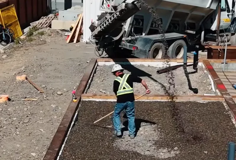
4. Lacustrine clay + silt (low-lying pre-glacial lake bottoms)
An Inglewood older-home soil report we reviewed in 2025 listed “lacustrine silty clay, varved, moderate plasticity, high water content, soft to firm, blow counts 4–12” at 2 to 5 m depth. The home had a documented history of slow basement settlement — the homeowner had been re-shimming interior doors annually for 11 years. The soil report explained it.
Lacustrine clay and silt deposits formed in pre-glacial lake basins during the late Pleistocene and early Holocene, when meltwater from retreating glaciers ponded in topographic lows. They appear in parts of Inglewood, Sunalta, lowland sections of Bowness, certain Mission and East Village micro-zones, and occasional pockets in lowland acreage. They’re typically soft, high-moisture-content, moderately plastic, and prone to consolidation settlement under building load per Alberta Geological Survey Bulletin 053.
The geotech markers for lacustrine soils are clear: SPT N-values are low (4 to 15), water content is high (often above 30 percent), plasticity is moderate (PI 15 to 30), and the borehole log often notes “varved” structure — the visible seasonal layering you can see in a freshly cut core sample. If you see “lacustrine” or “varved silty clay” with N-values under 15, that’s the soil.
Lacustrine soils cause differential settlement — the building moves slowly downward over years, with the worst settlement under the heaviest part of the structure. The classic symptom in older Inglewood and Sunalta homes is cracked drywall on the second floor, doors that won’t close in winter and won’t open in summer, and a basement floor that no longer reads level on a 6-foot straightedge.
The engineering response varies with severity: spread footings sized for low bearing capacity work for lighter structures, but heavier or more sensitive buildings often need piles or grade beams. The APEGA Practice Standard for Building Foundations covers the design approach in detail.
Lacustrine clay is the slow-failure soil. The next one — fluvial sand and gravel — is the river-channel soil that’s usually friendly but can hide bad surprises around drainage.
5. Fluvial sand + gravel (Bow + Elbow River channels)
A Sunnyside soil report from late 2025 listed “fluvial sand and gravel, medium dense, low plasticity, high permeability” at footing depth. The lot sits on old Bow River alluvium — the river’s footprint before the 1932 channel stabilization and the modern flood-mitigation work that followed the 2013 event.
Fluvial sand and gravel deposits are river-channel and floodplain materials deposited by the Bow and Elbow rivers over the last 10,000 years. They show up in Bowness, Sunnyside, Mission, parts of Inglewood, the river-bottom edges of several northeast and southeast new communities, and the long ribbon of older neighbourhoods that follow the river corridor. They’re characterized by high permeability, low plasticity, moderate-to-high bearing capacity, and minimal swell potential per Alberta Geological Survey Bulletin 053.
The geotech markers are straightforward: a well-graded granular profile in the borehole log, plasticity index below 10, moderate-to-high SPT N-values (20 to 40), and the geotech’s permeability note. If you see “fluvial” or “alluvial sand and gravel” with low PI and good N-values, that’s the soil.
Fluvial soils are generally foundation-friendly on the wall side. The vulnerability is around drainage. High permeability means water moves quickly into and out of the soil, which can carry fines and cause local subsidence around poorly designed weeping tile outlets, downspout terminations, and sump discharge points. We’ve seen 1- to 2-inch local settlements develop within 5 to 7 years on Bowness and Sunnyside homes where the original drainage outlets weren’t erosion-protected.
Concrete Alberta drainage and backfill practice covers the standard outlet detail, and The Soil Around Your Foundation in Calgary walks through what good drainage design looks like on a fluvial lot. Minor settlement issues are also common in pre-1980 river-bottom Calgary homes from before drainage detailing became standard practice.
Fluvial sand is the river soil. The last one — organic muskeg-derived fill — is the rare but most-dangerous Calgary soil in the residential record.
6. Organic muskeg-derived fill (occasional in NE Calgary, lowland acreage)
A northeast Calgary acreage soil report flagged “organic muskeg-derived fill, 0.8 m thick, peat content 35 percent, high compressibility, undrained shear strength under 25 kPa” overlying glacial till at 1.5 m. The buyer almost walked. After review with the structural P.Eng., the lot moved forward with a pile foundation that added roughly $58,000 to the build budget. Without that engineering response, the building would have been a slow-motion disaster.
Organic muskeg-derived soils (and sites with significant organic content from old wetlands that were filled during early development) have very low bearing capacity, very high compressibility, and decomposition-driven settlement that continues for decades. They occur occasionally in northeast Calgary lowland sections, on lowland acreage that was wetland or muskeg before clearing, and on a small number of pre-development wetland sites that were filled without engineered remediation per Alberta Geological Survey Bulletin 053 and municipal geotechnical investigations on lowland northeast Calgary properties.
The geotech markers for organic soils are unambiguous when present: organic content above 5 percent in the lab analysis, peat layers visible in the borehole core, very low SPT N-values (often below 5), and very high water content. The classification “OL,” “OH,” or “Pt” (peat) under the Unified Soil Classification System will appear in the soil report. If you see any of these on a Calgary residential geotech, you need a structural P.Eng. on the file before you go any further.
Organic soils require removal or specialized foundation systems — piles, deep grade beams, or full removal and replacement of the organic layer with engineered fill. Building on organic content without engineered remediation produces the most extreme settlement failures we’ve seen on Calgary residential properties: 4 to 10 inches of settlement over a decade is not unusual. The remediation budget can range from $25,000 for shallow removal and replacement on a small footprint to over $80,000 for piling on a larger building.
That’s the six. If your soil report names any of them, the next conversation is with your structural P.Eng. about the foundation system that matches the soil. The matrix below summarizes each soil, where it shows up in Calgary, what failure mode it delivers, and the engineering response that prevents it.
Summary matrix — 6 Calgary soils at a glance
| Soil | Where in Calgary | Failure mode (year 3–7) | Engineering response |
|---|---|---|---|
| Bearpaw smectite clay | SE belt (Cranston, Mahogany, Auburn Bay, McKenzie Towne, Seton, Lake Bonavista) | Horizontal mid-wall cracking from spring re-wetting | Clean granular backfill + dimple board + weeping tile + conservative wall design |
| Paskapoo bedrock | NW + foothills (Killarney, Hillhurst, Bowness, Springbank, Cochrane, Bragg Creek) | Generally low risk; cost driver is excavation difficulty | Standard Part 9 prescriptive design + cost contingency for ripping/blasting |
| Glacial till | Central (Mount Royal, Marda Loop, Capitol Hill, Renfrew) | Low risk on walls; cobble excavation cost + occasional soft pocket | Standard Part 9 + excavator with rock bucket + spot remediation as needed |
| Lacustrine clay + silt | Lowland (parts of Inglewood, Sunalta, lowland Bowness, Mission micro-zones) | Slow differential settlement (years) | Spread footings sized for low bearing + piles or grade beams on heavier builds |
| Fluvial sand + gravel | River channels (Bowness, Sunnyside, Mission, river-bottom Inglewood) | Local subsidence around drainage outlets | Erosion-protected outlets + standard drainage detailing |
| Organic muskeg-derived fill | NE lowland + acreage wetland sites | Extreme settlement (inches per decade) | Remove + replace, or pile foundation, engineered by structural P.Eng. |
The soil-report cost range for a single-borehole or two-borehole Calgary residential investigation is roughly $3,500 to $8,500 in 2026 prices, depending on depth, lab work, and location — validate against current Calgary quotes for your specific lot. Frost depth in Calgary is 1.2 m per NBC(AE) 2023, which sets the minimum footing depth before any soil-specific design decisions get made.
If you’re looking at a soil report right now and you don’t recognize the formation names or markers above, What Your Geotechnical Report Is Actually Telling Your Foundation Crew breaks down a sample report line by line. And if you’re earlier in the process — still evaluating an acreage lot or a teardown — Building on Acreage Near Calgary and 8 Hidden Costs in a Calgary Acreage Foundation Quote cover the geotech budget and the questions to ask before you sign anything.
FAQ
Q1: What is the Bearpaw Formation? The Bearpaw Formation is a Late Cretaceous marine shale-and-clay sequence underlying much of east and southeast Calgary. It was deposited at the bottom of the Western Interior Seaway roughly 75 million years ago. Its smectite clay content swells 10 to 15 percent from dry to saturated, which is the dominant cause of horizontal mid-wall cracking in southeast Calgary basements per Alberta Geological Survey Bulletin 053.
Q2: What is the Paskapoo Formation? The Paskapoo Formation is a Paleocene sandstone, siltstone, and claystone sequence approximately 600 m thick. It forms the bedrock under most of west and northwest Calgary and the foothills — Killarney, Hillhurst, Bowness, Springbank, Cochrane, Bragg Creek. Bearing capacity on intact Paskapoo is high (600 to 1,500 kPa) and weathered Paskapoo fines have modest plasticity. It’s generally a foundation-friendly Calgary soil per Alberta Geological Survey Bulletin 053.
Q3: How do I read a Calgary soil report? Focus on six items: depth profile (what’s at footing depth versus deeper), SPT N-values (blow count — higher means denser, better bearing), plasticity index (higher means more swell potential), water content, allowable bearing capacity recommendation, and soil-specific warnings such as smectite, organic content, or “soft” notes. The borehole log identifies each formation by name; if you see “Bearpaw” or “Paskapoo” or “lacustrine” or “muskeg,” look up the markers above.
Q4: Do all Calgary lots need a geotechnical report? APEGA requires foundation design based on documented soil conditions for any design that falls outside NBC(AE) 2023 Part 9.4 prescriptive provisions — which covers most custom builds and any complex site. Standard infill builds in established neighbourhoods often use prescriptive Part 9.4 design without a site-specific geotech, but lenders and buyers increasingly ask for one regardless. The APEGA Practice Standard for Building Foundations covers when a site-specific investigation is required.
Q5: What’s the cost difference between soil types? The cost driver isn’t the soil type by itself — it’s the engineering response the soil requires. Bearpaw lots typically add $2,500 to $8,000 for clean granular backfill plus drainage upgrades over a standard Calgary basement. Lacustrine lots can add similar amounts for upgraded footings, or more for piles. Organic-soil lots can add $25,000 to $80,000+ for removal and replacement or a piled foundation. Industry-survey ranges as of 2026; validate against current Calgary quotes for your lot.
Q6: Can I appeal a “high swell potential” rating? Not in any practical sense — swell potential is a measured property of the clay, not an opinion. The engineering response (clean granular backfill, dimple-board drainage, weeping tile to positive outlet, conservative wall design) accommodates the swell, but the soil itself doesn’t change. The right move is to budget for the engineering response, not to try to relabel the soil.
Sources
- Alberta Geological Survey Bulletin 053 — Calgary surficial geology, Bearpaw Formation, Paskapoo Formation — https://ags.aer.ca
- APEGA Practice Standard for Building Foundations — https://www.apega.ca
- NBC(AE) 2023 — Part 9 (housing and small buildings) and Part 4 (structural commentaries), in force in Alberta since May 1, 2024 — https://www.alberta.ca
- CSA A23.1:24 — Concrete materials and methods of concrete construction (14th edition) — https://www.csagroup.org
- Concrete Alberta — drainage and backfill practice resources — https://www.concretealberta.com
- City of Calgary — Climate Hazards Report (30-year average frost data) — https://www.calgary.ca
About Omega 2000 Cribbing
Omega 2000 Cribbing has cribbed foundations across Calgary and the surrounding acreage belt since 1988. The 38-year span across Bearpaw, Paskapoo, glacial till, lacustrine, fluvial, and organic-soil lots is how we name the failure mode behind every horizontal crack we get called to look at.
Building on Calgary Soil? Start With the Ground Before You Price the Concrete.
Every successful foundation starts with understanding the soil beneath it—not just the concrete above it.
At Omega 2000 Cribbing, we’ve been building foundations across Calgary and the surrounding acreage since 1988, working on everything from Bearpaw clay in southeast communities to Paskapoo bedrock in the west and glacial till across the inner city. That experience helps us identify potential foundation risks before excavation begins, coordinate with your geotechnical engineer, and recommend foundation solutions that match the conditions on your site.
Whether you’re building a custom home, an infill, a multi-family project, or developing acreage, our team can review your geotechnical report, discuss constructability, and provide a foundation estimate based on your site’s actual soil conditions—not generic assumptions.
Contact Omega 2000 Cribbing today to review your geotechnical report or request a foundation quote for your Calgary project.